William Coxe - Europe in Copperplate. A Journey That Became an Atlas of the World
What did Europe look like just before the end of the 18th century? William Coxe takes the reader on a journey through Poland, Russia, Sweden, and Denmark, creating one of the most important testimonies of the era. It is a story about monarchs, great cities, maps, and the world seen through the eyes of a careful traveler


Voyage en Pologne, Russie, Suède, Dannemarc… (Geneva, 1786) is one of the most important works of European travel literature at the end of the 18th century — a testimony of an era in which travel was simultaneously an investigation, observation, and an attempt to organize the world.
The original author was William Coxe — an English historian and clergyman who traveled through Northern Europe between 1784 and 1786. The result was a multi-layered description of the world from Poland, through Russia, to Scandinavia.
Poland at the center of the European narrative
The first volume of the work is largely devoted to the Polish–Lithuanian Commonwealth. This is not a marginal mention — it is an extensive, over one hundred pages long description of the country, which in the traveler's eyes becomes an important element of the European political and cultural balance.
Coxe visits Warsaw, observes court life, and meets with the elites of the era, including King Stanisław August Poniatowski, whose portrait was preserved in the form of an engraving.

Poland is not just a backdrop here — it is a political, cultural, and intellectual space described from the perspective of a Western European observer.

The Russian Empire and an outsider's perspective
A significant part of the account is devoted to Russia, where the traveler describes both Moscow and the newly forming empire of St. Petersburg.

The pages of the work also feature the court of Catherine II — one of the most important political figures of 18th-century Europe. Russia is presented as a space of dynamic modernization but also cultural and civilizational contrasts.

Northern Europe: Sweden and Denmark
The last part of the second volume leads the reader through Sweden and Denmark — countries orderly described and illustrated with maps, city plans, and a portrait of King Gustav III.

All this creates a coherent image of Northern Europe as a political but also cartographic space — orderly, measurable, "readable" to the 18th-century eye.
Cartography as the language of the world
The 1786 edition, developed and enriched by P.H. Mallet, is more than just a travel account.
It is an atlas of ideas.
It contains:
- fold-out maps of Poland, Russia, Sweden, and Denmark
- plans of Moscow, St. Petersburg, Stockholm, and Copenhagen

- portraits of monarchs and political figures
- high-quality engravings, including those by Thomas Kitchin Thomas Kitchin


Each map here is not only an illustration — it is an interpretation of the world before photography, satellites, and GPS existed.
Binding and materiality of the object
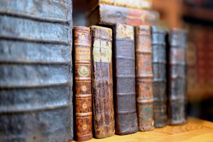
The copy in a half-leather hardcover, with raised bands, gilding on the spines, and marbled paper on the covers and endpapers, is an example of the highest class of European bookbinding.
It is an object that combines:
- science
- travel
- cartography
- and the art of the book
Conclusion
Voyage en Pologne… by Coxe is not just an account of an 18th-century journey.
It is the moment when Europe was "drawn" — before it was photographed.
Today we look at maps on our phones.
In 1786, people looked at the world through an engraving.
![COXE- VOYAGE EN POLOGNE, RUSSIE, SUEDE, DANNEMARC, etc. t. I-IV [komplet] wyd. 1786 - plany, mapy, portrety, ilustracje](/media/products/75d50a96ee963ac0fbd0a6f098606ecc/images/thumbnail/small_1_ec5a6800a6b2.jpg?lm=1765540569)
![COXE- VOYAGE EN POLOGNE, RUSSIE, SUEDE, DANNEMARC, etc. t.1-2 [komplet w 2 wol.] wyd. 1786](/media/products/b8f21245b312739b217104c2e22debf4/images/thumbnail/small_20180319-131604.jpg?lm=1765539383)
![COXE- TRAVELS INTO POLAND, RUSSIA, SWEDEN, AND DENMARK t.1-2 [komplet w 2 wol.] wyd. 1784](/media/products/4262cdc4947e971469c870cdf857bdb0/images/thumbnail/small_batch-20220527-140054.jpg?lm=1765540515)


![HISTOIRE DE SUEDE SOUS LE REGNE DE CHARLES XII [KAROL XII i STANISLAW LESZCZYNSKI ] wyd.1721 I-X OPRAWA ryciny](/media/products/1fd0faa4033f001d3e11fcd5a019d13a/images/thumbnail/small_1_829fdf131c13.jpg?lm=1765539389)
![[WYCIECZKA NA LITWĘ] BIBLIOTEKA WARSZAWSKA 1857 t.1-2](/media/products/efe4dc61e0035c8e887ce3aecf247334/images/thumbnail/small_wenet20260115-144211.jpg?lm=1768567735)
![KRASZEWSKI- KARTKI Z PODRÓŻY 1858-1864 ROKU I-II [komplet]](/media/products/ca3d64f1b384f696eeb70943479d1503/images/thumbnail/small_DSC08053.JPG?lm=1765539410)
![[BIARD] BIBLIOTEKA PODRÓŻY I MALOWNICZO-HISTORYCZNYCH OPISÓW RÓŻNYCH KRAJÓW. PODRÓŻ DO SPITZBERGA. Wilno 1857](/media/products/8c3aea3c3638d5851166864aac5ce36e/images/thumbnail/small_batch-20240916-113611.jpg?lm=1768929271)
![MANN - PODRÓŻ NA WSCHÓD. EGIPT, SYRYA I KONSTANTYNOPOL t.1-3 [komplet] wyd. 1858](/media/products/53b07723f3ef50efc9971a5adfe7ea33/images/thumbnail/small_batch-20221014-114528.jpg?lm=1765540333)

![BIBLIOTEKA PODRÓŻNICZA t.1-20 [komplet] mapy, ilustracje](/media/products/767e39e6e1f591b021d03d49dbf5825e/images/thumbnail/small_20190523-093856.jpg?lm=1765539355)


 Polish